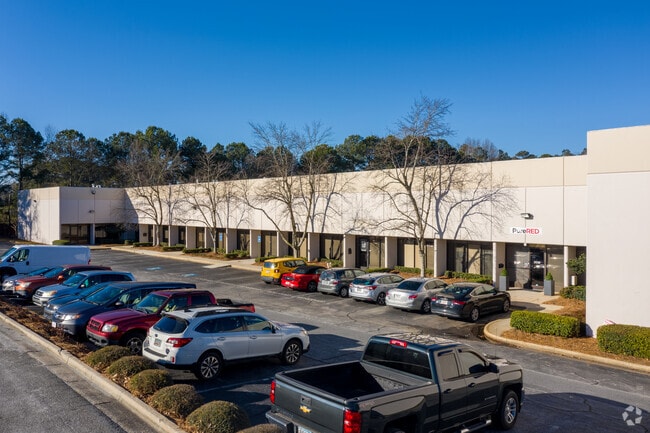
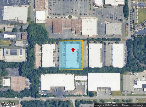
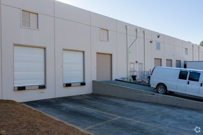
Property Record
2036 Weems Rd, Tucker, GA 30084
Current Lease Availabilities
NEARBY LISTINGS FOR SALE OR LEASE
Property Detail
2036 Weems Rd
18-190-03-006
07/24/89 JLM A-NC
Warehouse
DeKalb
X
Georgia
13089C0059K
6
2025
2.90 AC
2025
Stone Mountain
021821
Atlanta
54,203 SF
Atlanta-Sandy Springs-Roswell, GA
DEMOGRAPHICS near 2036 Weems Rd
1 Mile
3 Mile
5 Mile
2024 Total Population
7,295
96,368
304,996
2029 Population
7,264
95,843
305,957
Pop Growth 2024-2029
(0.42%)
(0.54%)
+ 0.32%
Average Age
41
38
37
2024 Total Households
3,394
37,930
120,874
HH Growth 2024-2029
(0.38%)
(0.54%)
+ 0.31%
Median Household Inc
$82,541
$79,216
$67,998
Avg Household Size
2.10
2.50
2.40
2024 Avg HH Vehicles
2.00
2.00
2.00
Median Home Value
$366,666
$363,447
$356,783
Median Year Built
1979
1975
1980
Nearby Places
- Restaurants
- Banks
- Shops
- Fitness
- Groceries
PUBLIC TRANSPORTATION
AIRPORT
Hartsfield - Jackson Atlanta International
DRIVE
WALK
Distance
Hartsfield - Jackson Atlanta International
33 min
23.3 mi
Nearby Properties
Address
Land Use
TOTAL SIZE
Lot Size
Zoning
Address
Land Use
TOTAL SIZE
Lot Size
Zoning
457,330 SF
20.49 AC
RM-HD
Address
Land Use
TOTAL SIZE
Lot Size
Zoning
377,506 SF
8.70 AC
X
Address
Land Use
TOTAL SIZE
Lot Size
Zoning
267,983 SF
13 AC
X
Address
Land Use
TOTAL SIZE
Lot Size
Zoning
325,232 SF
23.10 AC
X
Address
Land Use
TOTAL SIZE
Lot Size
Zoning
208,608 SF
20.89 AC
OI: OFFICE
Address
Land Use
TOTAL SIZE
Lot Size
Zoning
179,762 SF
4.96 AC
C1
Address
Land Use
TOTAL SIZE
Lot Size
Zoning
819,703 SF
55.80 AC
M
Address
Land Use
TOTAL SIZE
Lot Size
Zoning
503,480 SF
50.04 AC
RM150
Address
Land Use
TOTAL SIZE
Lot Size
Zoning
228,504 SF
15.57 AC
M
Address
Land Use
TOTAL SIZE
Lot Size
Zoning
70,929 SF
6.64 AC
C1: LOCAL
Address
Land Use
TOTAL SIZE
Lot Size
Zoning
355,421 SF
7.03 AC
X
Address
Land Use
TOTAL SIZE
Lot Size
Zoning
185,066 SF
25.53 AC
O-1
Address
Land Use
TOTAL SIZE
Lot Size
Zoning
313,420 SF
12.74 AC
X
Address
Land Use
TOTAL SIZE
Lot Size
Zoning
587,493 SF
29.79 AC
X
Address
Land Use
TOTAL SIZE
Lot Size
Zoning
222,799 SF
11.59 AC
X
Address
Land Use
TOTAL SIZE
Lot Size
Zoning
213,410 SF
20.68 AC
O-1
Address
Land Use
TOTAL SIZE
Lot Size
Zoning
169,005 SF
11.81 AC
O-1
Address
Land Use
TOTAL SIZE
Lot Size
Zoning
258,864 SF
16.50 AC
RM75
Address
Land Use
TOTAL SIZE
Lot Size
Zoning
297,909 SF
14.96 AC
RM75
Address
Land Use
TOTAL SIZE
Lot Size
Zoning
404,399 SF
31 AC
RM75
Address
Land Use
TOTAL SIZE
Lot Size
Zoning
221,780 SF
22.59 AC
RM75
Address
Land Use
TOTAL SIZE
Lot Size
Zoning
180,586 SF
8.70 AC
X
Address
Land Use
TOTAL SIZE
Lot Size
Zoning
385,221 SF
27.41 AC
RM85
Address
Land Use
TOTAL SIZE
Lot Size
Zoning
166,174 SF
19.70 AC
RM85
Address
Land Use
TOTAL SIZE
Lot Size
Zoning
135,350 SF
9.01 AC
RM-HD
Address
Land Use
TOTAL SIZE
Lot Size
Zoning
337,746 SF
29.94 AC
RM100
Address
Land Use
TOTAL SIZE
Lot Size
Zoning
262,160 SF
14.49 AC
RM100
Address
Land Use
TOTAL SIZE
Lot Size
Zoning
170,933 SF
15.39 AC
X
Address
Land Use
TOTAL SIZE
Lot Size
Zoning
252,216 SF
30.09 AC
RM75
Address
Land Use
TOTAL SIZE
Lot Size
Zoning
158,068 SF
9.21 AC
X
The World's #1 Commercial Real Estate Marketplace
Connect with us
© 2025 CoStar Group
The information above has been obtained from sources believed reliable. While we do not doubt its accuracy we have not verified it and make no guarantee, warranty or representation about it. It is your responsibility to independently confirm its accuracy and completeness. Any projections, opinions, assumptions, or estimates used are for example only and do not represent the current or future performance of the property. The value of this transaction to you depends on tax and other factors which should be evaluated by your tax, financial, and legal advisors. You and your advisors should conduct a careful, independent investigation of the property to determine to your satisfaction the suitability of the property for your needs.